Still have a question? Ask your question here
Be in first line
With AR glasses you feel in absolute control of the situation
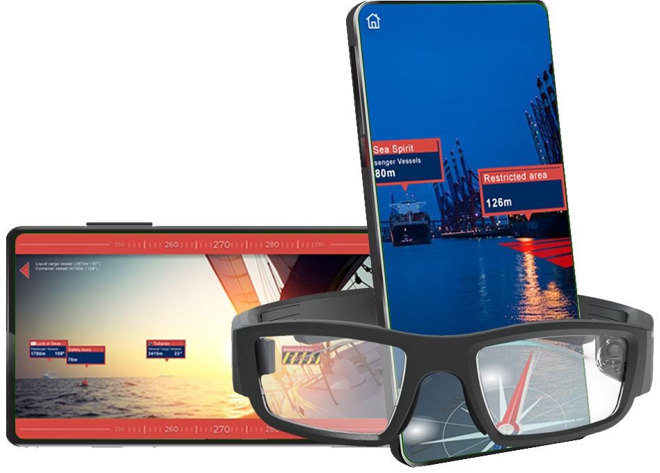
Navigating in tight harbors or even open waters can cause a lot of problems. But the AR layer makes everyone cope even in harsh conditions.

Just open application, choose map and you are ready.

Virtual elements in AR layer are placed with highest accuracy based on GPS coords.

Representations of objects are clear and legible even for people unfamiliar with the basics of navigation maps


Don’t worry at night because objects on the virtual layer are based on GPS coordinates, which are perfectly visible in the dark

This does not mean that the basics of navigation are redundant. But the Albatross will surely help you

Navigation allows you to sail in confined waters, coastal and high seas
There are three basic elements that are necessary for Albatros Navigation to correctly indicate objects. The first is your location, the second is the exact coordinates of the objects. The third and last is the direction you are moving. All three parameters are analyzed by algorithms and finally a virtual navigation map is created.
Your device know exactly where you are by using a GPS connection
From AIS to maps. Albatros Navigation is integrated with all system to get those informations
The most important is direction which you are watching. Using compass, system knows in which direction are you looking

Just grab your steering wheel with both hands and enjoy sailing. Glasses connected to your mobile device will show you the way
With AR glasses you feel in absolute control of the situation
All information displayed on the glasses is constantly updated
Maps are stored on your mobile device which connects to glasses with BT connection
Ships involved in incidents
Persons injured
Fatalities
Occurences
If you do not find the answer to your question below, you can write to us directly.
Albatros Navigation app is free. So you can download and run it. There are two free maps covering areas in Poland.
Yes, the free version has two areas located in Poland. The first one is the southern part of Masuria, and the second covers the Gulf of Gdańsk.
A minimum A9 processor is required for iOS devices. When launching the application, it will inform you if your device is compatible. For Android phones, check the device at this link: https://developers.google.com/ar/devices
We don’t need any information from you. Your account is created using popular social networking sites or email accounts. The application does not collect any data about you or your location for further processing.
Still have a question? Ask your question here
If you want to be up to date with the development of the application, you can subscribe to our newsletter. We will inform you about news, updates and the process of development
We don’t share your personal information with anyone or company. Check out our Privacy Policy for more information.